


Azlan Othman
Images and data produced from ‘Aerial Photography, Airborne LiDAR Acquisition and Geospatial Mapping of Brunei Darussalam’ project will be used to update the map and geospatial information of the Sultanate for public and private agencies involved in national development planning as well as disaster management.
This aerial acquisition project is one of the approved projects under the 11th National Development Plan (RKN11). Contractor Syarikat Juruukur Fadly will execute the project, expected to be completed within 18 months.
The outcome of the project will include aerial images and light detection and ranging (LiDAR) data of the whole of Brunei Darussalam.
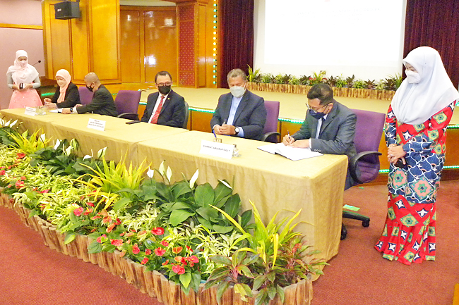
A contract signing was held between the Government of His Majesty Sultan Haji Hassanal Bolkiah Mu’izzaddin Waddaulah ibni Al-Marhum Sultan Haji Omar ‘Ali Saifuddien Sa’adul Khairi Waddien, Sultan and Yang Di-Pertuan of Brunei Darussalam, represented by the Survey Department at the Ministry of Development and Syarikat Juruukur Fadly at the Betabur Hall of the Ministry of Development yesterday.
Signing on behalf of the government was Surveyor General at the Survey Department Haji Arefin bin Haji Jaya while Syarikat Juruukur Fadly was represented by its Managing Director Haji Mahadi bin Haji Mohd Tahir.
The signing was witnessed by Deputy Minister of Development Dato Seri Paduka Ar Haji Marzuke bin Haji Mohsin.
Permanent Secretary (Infrastructure, Housing and Professional) Ir Haji Amer Hishamuddin bin Pehin Orang Kaya Amar Pahlawan Dato Seri Setia Haji Zakaria; Deputy Permanent Secretary (Construction Industry and Development) Sr Hajah Norhayati binti Haji Mohd Yaakub; Deputy Permanent Secretary (Corporate and Law) Aldila binti Haji Mohamad Salleh; Director General of Public Works Ir Haji Md Salleh bin Haji Abdul Karim; senior officers as well as officers under the Survey Department, project consultants from KT Ryan Communications and Services and contractors of Syarikat Juruukur Fadly were also present.