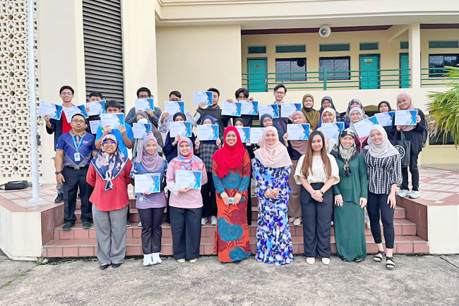
Network Integrity Assurance Technologies Sdn Bhd (NiAT), the sole local satellite communication service provider in Brunei Darussalam, recently hosted a World Geographic Information System (GIS) Day capacity-building programme (CBP) at the Institute of Brunei Technical Education (IBTE) Nakhoda Ragam Campus.
The one-day event was held in conjunction with GIS Day, celebrated on November 16.
Twenty-two HNTec in Geomatics and HNTec Real Estate students and instructors from the IBTE Nakhoda Ragam Campus took part in the event.
Present were Head of School of Building Technology Services, IBTE Nakhoda Ragam Campus Noorisman bin Mentarais; Acting Academic Management Officer at IBTE Nakhoda Ragam Campus Shahrimawaty binti Abdul Karim; Deputy Chief Executive of NiAT Siti Nur Aazzah binti Pehin Dato Haji Abdul Aziz; instructors and staff of IBTE Nakhoda Ragam Campus and NiAT; as well as students.
In her opening remarks, Siti Nur Aazzah stressed that GIS has become an integral element of many disciplines, intersects across every aspect of the modern information system, and that everyone may benefit from GIS knowledge and learning how to use GIS technology.

“GIS covers remote sensing, satellite imagery and mapping tools. Location is everything nowadays. Location drives our lives. GIS data provides longitude, latitude and other location intelligence. GIS data extraction enables us to answer questions such as ‘Where should you locate your business?’, ‘Where to buy a house?’, ‘Where should you send your kids to school?’, ‘Where will I be less at risk of a natural disaster?’, or ‘How you utilise GIS to leverage or extract the value of location holistically?’.
She explained that the session serves as a practice towards generating spatially literate learners who can visualise and analyse location, distance, direction, connections, movement, and change using satellite imagery and space.
The programme proceeded with a training session by NiAT GIS Engineer Emily Yong Pey Pey, who trained the participants to use the ArcGIS platform prior to the commencement of the hackathon.
The participants were challenged to sketch the roofs of Lugu national housing and Katok national housing in groups of two. They were given access to GIS software and a satellite imagery base map of Brunei, which they used to trace the roof’s outline as seen in satellite images. In addition to learning how to create a 3D map of the house, students used the map to build data layers based on image interpretation.
The map overlays created by the students will potentially be incorporated into NiAT’s potential solar power project, which will quantify the amount of solar radiation that can be absorbed by building roofs. Each group presented their results and maps to the audience and described how they obtained their geographical data and content with GIS.
Siti Nur Aazzah and Emily Yong presented certificates to participating students. One group was awarded Speed Mapper, while two others were given Most Outstanding Map.
Participants look forward to exploring and learning more about GIS technology, GIS capabilities, and GIS tools in the classroom.


